Friday, February 3, 2012

An Email Gift

       From time to time, I receive a gift from a reader. Such is the case here: the attached document is the death certificate of Santiago "Jimmy" McKinn.  Tidbits of information have tricked in over the years since I first published "The Captive," which is the story I compiled on the abduction of Santiago McKinn as well as the death of his older brother, Martin.
       On September 11, 1885, Geronimo led a group of raiders into the U.S. seeking, as always, guns, ammunition, perhaps other supplies as well. The location of the ORIGINAL McKinn household (homestead), which I originally believed was located along current New Mexico Highway 61 in the lower Mimbres River Valley, may actually have been located several miles up Gallinas Cañon, to the north & east of NM 61 near current Royal John Mine Road's entrance to the highway.
        If so, it was a lonely place. Father John McKinn left the two boys to watch his herd of cattle ... perhaps 100 head in all.  John McKinn, some say, managed as an Irish immigrant to the U.S. in the 1840s, made enough money gold mining he could buy the herd of cattle the boys were watching. Regardless, he had gone to Mesilla that September 11, 1885 day, for fruits & vegetables. He undoubtedly had put Apache raiding out of his mind as the Apaches had been moved father West, into Arizona.
       Doubtless, 99.99% of immigrant settlers in the Mimbres Valley in 1885 scarcely knew the footprint of a highly motivated, highly skilled raiding party of Chiricahua Apaches could be. Remember: the main bodies of Apaches in 1885, were mostly located south of the Border, in northern Chihuahua & Sonora ... 200 miles away!
      Read my article "The Captive," to learn the entire story. The updated record for the incident will be included in my new book.
   

Tuesday, December 6, 2011

         I'll be experimenting with some historical features/documents that I will make available for the upcoming article on maps & boundaries & lines.
         There will be a number of historical documents available for viewing.
         The National Archives & Records Center in Washington, D.C., have millions upon millions of documents that relate to just about every possible subject matter that has fallen under the knife of cataloguers & list makers. In the case of the millions upon millions of documents that are devoted to the era of the Indian Wars, circa 1860-1899, there are numerous maps.
          The map below could as easily be called a "drawing" of the fire fight that occurred in October, 1869, between the forces of Lt. Col. Reuben Bernard. The drawings were made by a soldier & officer who were at the battle, and recorded in charcoal, I suspect, or pencil, the terrain in what is known as Tex Cañon.  Ft. Rucker was eventually opened along the route to the place called "The Rocky Mesa" fire fight site.  This was covered in an article I wrote about Lt. John Lafferty.
          In that article, Edwin Sweeney, the preeminent author of the history of the Chiricahua Apaches, visited the site so as to conincide with a party of Fred Lafferty & his wife, Betty, as well as a grandson named "Boomer" & his father, a man named Head.  I was along, and we wound up going to the site where this battle occurred. It is so unusual that a "map" is colocated in the National Archive records on microfilm in the sense that this is as much a drawing as a map.
          The legend for the map has a list of #s, which are penciled into the large terrain feature where Lt. Col
Bernard's men encountered the forces of Cochise in Tex Cañon.  By using those numbered locations, we were able to go as close as possible to the actual site (a large boulder), where Lt. John Lafferty had a portion of his jaw shot away. This was a permanent disabling wound, and he was pensioned out of the Army a few years later.
          I will also include other maps which accompanied "scouts," or what would amount to patrols, from various forts & camps. Often, those scouts recorded how many miles were "marched" in a day; whether water; timber; and grass were available for consumption & use by the cavalrymen & infantrymen.  "Marched"
is a term that denotes the # of miles made or traveled in a given day.  Even in the case of infantry units, the distances in Arizona & New Mexico Territories was so vast that infantry rode on mules in many cases.
      The microcopy series of National Archives microfilm rolls for this particular period is titled: Microcopy 619: Letters Received by the Office of the Adjutant General (Main Series), 1861-1870, Roll 737 1869,  733-925.  A partial index is also provided for that roll of microfilm of microcopy #619.  These are the raw notes of the people who prosecuted the war against the Apache Indians of Arizona & New Mexico in this time frame -- i.e., specifically: 1869.  The troops of Lt. Colonel's Bernard troops were stationed @ Ft.Bowie.
       This area of the Chiricahua Mountains was just one part of the vast area that fell within the territory claimed by Cochise & his particular band of Chiricahua Apaches.

           I believe if you use whatever key stroke available to use to enlarge these images, you will see more detail.  Credit is given to
         Here are a few:

Monday, October 10, 2011

The Peloncillos and ....

     One of my stalwart supporters, Kevin, from Dallas, is coming this week (of 12 October). We did a trip out here where we "hiked Apacheria" four or five times in March. We'll keep closer to the Silver City area for the amount of Kevin's time here I can be a part of. That ends on 17 October for me. At any rate, I hope to sum up the trip Brian Huberman & I made to Mexico in the summer. We prefer to not provide any logistical or personal information as we'd like to return & explore more deeply what the Mexican Apacheria means in real, 21st Century terms.
     It's clear to me that because Mexico off road is still pretty much the same as it was when the last Apaches were exiled to Florida in 1886, it's a different experience hiking there. I truly want to hike down there. It's clear, though, that it's not possible to do that without feeling like I'm back in Vietnam. This is because the cartels control many remote parts of the country as well as huge urban populations.
     The few locals we met are certain Calderon's policies will not be vindicated in the 2012 election.
     They believe many Mexicans will BLAME Calderon for all the violence, since he's so heavily pushed a non-traditional Mexican approach to corruption &; crime: unremitting confrontation.  Calderon's a PAN candidate and the clearly, in many Mexican voters eyes, has rocked the boat too aggressively.

http://en.wikipedia.org/wiki/Felipe_Calder%C3%B3n
http://en.wikipedia.org/wiki/Institutional_Revolutionary_Party
      The PRI has held control of Mexican politics for some time.
      I'd try & find some Mexican newspapers that may be in English so that I can begin to gather information
on the PRI's chances for sweeping the national offices. If my friends are correctly, they think Mexican voters want the government to go after the peso power the cartels have ... & not be so aggressive on the people within the drug trade.
       My guess is: the U.S.A. is seen as the big lumbering giant it always has been to Mexico, but that the giant has a serious addiction to drugs problem that has caused or led to massive slaughter in the streets & countryside by cartelistas & "sicarios," (i.e., "hit men" or "thugs"). One friend told me lately that in a certain part of a rural Mexican area of Chihuahua, La Linea, the enforcers, have spread the word they're coming to that area to probably kill members of rival cartels.
       Take a look @ Googleearth.com
as I have, and just "fly over" Mexico. There are enormous areas where the countryside is remote, backward looking in terms of small villages & towns scattered in rugged mountain or desert areas. There must be enormous fields of marijuana growing. My friend who lives south of Casas Grandes, tells me that this part of Mexico (Chihuahua but closer to Sonora
http://en.wikipedia.org/wiki/Sonora
than Coauhila, Durango, etc.,
http://en.wikipedia.org/wiki/Coahuila
http://en.wikipedia.org/wiki/Durango
has seen escalating presence of cartel people in the last two years. She & other Americans living there have
left the area.
        I would guess that the election will see a reversion to the PRI in many places, probably the national government. While the U.S. will do what it can to ensure a continuation of Calderon's policies, if my friends are right, the indicators say they will not flow seamlessly forward. I suspect accommodations will be suggested to legitimize at least marijuana in some way. Mexico could easily just declare marijuana legal & force the U.S. to do something about it.
       One wonders what would happen ... would millions of Notre Americanos head south to live where they can legally smoke dope all the time?
       Mexican cartels are clearly fostering marijuana growth INSIDE the U.S., @ national parks and forests.
       They mean to muscle out American marijuana growers, I'm sure, & that could escalate violence here, in the U.S.  Perhaps American military units, leaving Iraq & Afghanistan, will begin patrolling our parks & forests and BLM lands. There would be some significant high-tech technology brought to bear against Mexican cartel marijuana growers north of the Border.
        With gridlock in the States, Comprehensive Immigration Reform seems impossible to believe will happen. Only if President Obama wins re-election can there be any hope of that happening.
       If he wins, it will be because he promises comprehensive reform's possible passage under a Democrat President & perhaps, Democrat House of Representatives, w/enough Senate Democrats to move legislation forward.
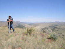
       In the meantime, here are some photos of our trip to Mexico & also, of the Peloncillos as well as photos take @ the Arizona Historical Society's Geronimo exhibit.
       The following book is well worth the read:
       http://www.amazon.com/Mexico-Narco-Violence-George-W-Grayson/dp/1412811511/ref=sr_1_1?ie=UTF8&qid=1318253982&sr=8-1
       It's by George Grayson, and is titled: Mexico: Narco Violence and Failed State.
       Grayson's described in detail the various drug cartels that perpetrate violence & mayhem on the Mexican
people. I know that were it possible, I'd be down in Mexico, searching with Mexican Apache aficionados for places the Apache were during the last 25 years of their existence as semi-nomadic peoples. But, those days may have disappeared for me, due to the horrific violence underway.
       A few more photos:
           This photo is a close up of the Apache scouts @ Cañon de los Embudos. It shows a close up of the Scout, Mule Skinner, translator, cowboy, Tom Horn. Tom Horn is the central character in the last film Steve McQueen starred in. Tom was from Missouri, and according to some, a sociopathic killer. He certainly later became a "regulator" (see the film "Tom Horn," but also, "Missouri Breaks" w/Jack Nicholson, Harry Dean Stanton, Randy Quaid  & a chubby Marlon Brando).  "Regulators" were paid to kill or drive off "sod-busters" ... i.e., small time farmers who threatened to break up the "Open Range," which is another excellent western with
Robert Duvall, Kevin Costner & Annette Benning.
              Geronimo's death certificate. He had been in to the nearest town to Ft. Sill, and got drunk. He
either fell off his horse, and lay all night near the railroad tracks, or got off his horse to urinate, then lay down and spent the night out in the elements. It might have rained on him. In his eighties, he contracted pneumonia and died of complications.
       The exaggerations & poor scholarship on the part of local Apaches has shown up in the otherwise excellent series of exhibits @ the Silver City Museum. A local Apache perpetuates the myth that the Chiricahuas who were shipped east, to Ft. Marion (St. Augustine) or Ft. Pickens (Pensacola) Florida,
were shipped east in boxcars.
       The image above showed the Geronimo contingent of Chiricahuas beside the train tracks that took them east, but also, with Pullman cars in the background. There's no boxcars in the background because the
Apaches (including the larger contingent of Apaches including: Loco; Lozen; Chihuahua; Olsanny; all Army scouts who assisted in finding Geronimo, etc.) were shipped east from either Hollbrook, Arizona, or Bowie, Arizona ... were all assigned to Pullman cars.
        To prevent Apaches such as Massai from jumping the train & returning to New Mexico or Arizona, the Army did nail the windows shut en route to Florida. It mad for close, stifling & unhealthy conditions for the
Apaches as they went east. They weren't used to toilets or any means of relieving themselves on a moving train. They also had difficulty eating the American Army food en route.
      But ... they certainly weren't shipped in boxcars.


Tuesday, August 9, 2011

Wikipedia

Support Wikipedia

Cañon de los Embudos - 2011


Recently, with the help of some fantastic Mexican hosts, I was able to return to Cañon de los Embudos, where General Crook & Geronimo met to discuss the latter's surrender in 1886. It was with some serious forethought & careful review of the security situation in Mexico that we went. The guy who has been filming a documentary for over six years (four with me in the scheme of things) went with me. We had assurances from our Mexican hosts that we would be safe there, @ their place, that we were able to visit Puerto Palomas; Ascension; Janos; one of the colonia des Mennoites; Montaverde. We also visited Cañon de los Embudos.
To visit Cañon de los Embudos, we had to separate out their earlier visits to "El Embudos" which are on the eastern side of the Sierra los Embudos & Sierra de San Luis. The relative height of the former are around 2200 meters (over 6600 feet). There are many mountain ranges that move off & run from north to south, some of which are also in the U.S., as well as other ranges that run more northeast, southwest.
Sierra los Embudos is in that posture.
It's necessary to enter & drive through both Chihuahua & Sonora States.
With only a passport needed for a short visit, & as we had no vehicle to register with Mexican auto insurance, we rode w/our Mexican hosts w/a sense of greater safety.
We encountered military check points @ several locations.
The check points were manned by serious but young soldiers. All carried assault rifles & there were several machine guns present @ each check point.
It looked like a squad of soldiers @ each check point.
It is vital that anyone expecting to visit Cañon de los Embudos w/out any knowledge of where the place is located, to get lost.
There are many mesas & potential contenders for "THE Cañon de los Embudos." I recalled the directions well
enough to get us there again.
Even so, w/more information it's now clear to me that there are multiple locations for rancherias.
Use of Jay Van Orden's Monograph (published by Arizona Historical Society) on C. S. Fly's famous photo series of these momentous talks is essential to even coming close to finding the area where the surrender took place.
There are several interpretations as to where the rancheria in Fly's photos are located.
Here are a few photos from this visit.
In talking with Jay Van Orden we feel confident that while we weren't precisely on the site of the surrender conference between General Crook & Geronimo, Naiche, Chihuahua, Alchesay, Nana (Na-NAY) and Olsanny (Ulzana), we were close.
Again: do not attempt this trip alone. Do not attempt this trip if you speak no Spanish. Had we not had fluent Spanish speakers w/us, we likely would NOT have had the good fortune to find this place.
Do not drive after dark.
Do not assume you will be able to travel about at any time without encountering danger.
Sadly, Mexico has been transformed by the violence.
ON THE OTHER HAND, our hosts were wonderful & imparted enormous new information. We also learned about sotol, which is the indigenous drink of Chihuahua. Taken from the desert spoon yucca, it's not mescal nor is it tequila.
It's the "state drink" in terms of naturally harvested products.
While sotol is more expensive than tequila or mescal, it's supposed to be quite the drink. It can be mixed w/other modifiers.
We hope very much to revisit our hosts soon & expand the knowledge we Americano & Mexican Apache students of history love.
Photos: Top Left to Right; Left to Right:
General area of surrender conferences, Cañon de los Embudos;
Scene looking south into Mexico, EAST of Cañon de los Embudos, on Highway 2;
Sierra los Embudos & key landmark of surrender area;
General area of conference surrender discussions;
Looking south into Mexico, from road into Cañon de los Embudos;
the northeastern extent of Cañon de los Embudos;
Military Checkpoint.


Labels: ,

Wednesday, August 3, 2011

New Photos Coming UP

There'll be some new photos coming up soon.
I'll be on the pending August 7th "Voices Of The West," from Emil Franzi's program of same name, Arizona Time (4 PM), New Mexico Time, 5 PM. I hope to talk up the current article, "From Water To Water," & also mention the Arizona Historical Society in general, & the outstanding exhibit on: "Geronimo: Revered & Reviled."