Third Posting On Cañada Alamosa Mineral Rights Issues
Thursday, April 29, 2010
Posting on Cañada Alamosa Mineral Issues
Here's what I posted yesterday in regards to the decision on drilling on the Sullivan's land there @ Cañada Alamosa.
I would suggest that the legal fees for an appeal will be in favor right now of the defendants.
The plaintiffs have a harder road to go in terms of burden of proof.
That means, lots of legal research & time in court.
Big money for a law suit @ this point.
I would suggest also that Chihene N'de try & research previous land claims that were adjudicated in the 1960s & 1970s. They are referred to specifically in the bibliography of "Loco: Apache Peace Maker," the new book on the life & times of Loco.
Albert Schroeder worked on some of those cases in terms of researching the homelands of various Apache
groups.
Some of that material may be available @ the New Mexico State Records & Archives Center, in Santa Fe.
The Chihene N'de, if I'm not mistaken, were given the chance to return to Ojo Caliente in 1910 or 1911, and chose
not to return. They chose Mescalero & Ft. Sill.
I think there was yet another attempt @ taking back the land there @ Ojo Caliente, part of which the Sullivan's might have owned.
Not sure of the disposition. Perhaps there was a settlement?
The case is clear that the drilling sites are on private land & that the mineral rights are private.
If the Chihene N'de have not historically considered & claimed the Red Paint Cañon in other legal cases, then
this would be a "new claim" that would fall outside, even, of previous claims. That would work against the Band, I
think.
Tying the Cañon to previous claims would help if the claims are it is sacred land.
I hope that the 1000 foot wells will NOT leak into the aquifer when drilled.
It sounds like if there is a road into the Red Paint Cañon, that will minimize the amount of traffic coming across
the Rio Alamosa, but if traffic comes down from Magdalena, then that could add silt problems in the rainy season,
by trucks driving across the ford.
I hope there is at least another meeting on this, but right now, the cards are stacked against the Chihene N'de, and
those who wish to keep the Cañada as pristine as possible.
I got the following letter from the office of Bill Branchard, under the New Mexico Energy Minerals and Natural Resources Department
RE: Notice of Permit Approval, Sullivan Ranch, Part 4 Exploration Project, Permit No. SO014ER, BE Resources Inc., Socorro County, New Mexico
The New Mexico Mining and Minerals Division (MMD) is providing notice of the approval of BE Permit N0. SO014ER. The Sullivan Ranch Part 4 Exploration Project area is located approximately 16 miles north of Winston, in Socorro County, New Mexico within Special Section 2, in T9-8S, R7W (township & range information), N.M.P.M. The exploration drilling project area is situated upon private mineral claims located on private land owned by Kenneth and Cherrill Sullivan and consists of 5 drill holes, from 5 to 10 inches wide, and up to 1,000 feet deep. The application states that less than 0.5 acres will be disturbed. Surface distribution will include the construction of no more than 5 drill pad areas. Some overland travel within the project area will be used to access each exploration drilling site, as well as existing roads. A copy of the approved Sullivan Ranch Part 4 Exploration Permit is available for review at the MMD offices, in Santa Fe, NM (Wendell Chino Building, 3d floor, 1220 South St. St. Francis Drive). Additionally, the approved permit, as well as supporting documentation, is available by visiting the MMD Website at: http://www.emnrd.state.nm.us, and then clicking on Pending
Permit Applications.
http://www.emnrd.state.nm.us/MMD/MARP/MARPNewPermitApplicationsandCloseoutPlans.htm#ExpApproved
If you go through these, in order, you'll see @ least one map of the proposed area for drilling. If I understand it correctly, the access road to the proposed drilling site will be via an access road of some kind off the road from Winston to Dusty. It would appear, if that's the case, that truck traffic would not be needed to cross Rio Alamosa, but that's just a very tentative purview.
I would appreciate it if any of you have photos that can be sent of the Red Paint Cañon, so that I could gain a better
understanding of proximity of the drill hole areas in relation to the Red Paint Cave.
I'd guess there are appeal rights to this permit approval, but that is likely where legal fees get sticky, and costly.
Appeals are generally not overturned if all the procedural wickets were followed precisely.
Sometimes, appeals can be overturned if based on faulty factual evidence provided, or, some pertinent information
was NOT reviewed as part of supporting documentation to either seek approval or denial of such claims.
The letter finally states:
"If you have any questioins, please contact me @ (505) 476-3435, or Joe Vinson of my staff @ (505) 476-3414."
Chuck Thomas
I'd guess any of you who wrote letters will get similiar notices. I sent an email protest to Mr. Branchard's office some
months back.
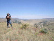
Here's a few photos of Ojo Caliente in early April. Hoopefully, most have visited the site.
I learned in April that there are TWO warm springs on the east or north side of the river. Also, a third spring was
coming into the Rio Alamosa from the same side of the river.
I will see if I can download the entire package & post on my web site:
www.hikingapacheria.com
I made my pitch on a spiritual basis, while I know others suggested this was a sacred tribal site, or that it had
employment advantages that should be considered.
I noted that other applications on file appeared to be connected with Native Lands.
Jerry Eagan
Silver City
I would suggest that the legal fees for an appeal will be in favor right now of the defendants.
The plaintiffs have a harder road to go in terms of burden of proof.
That means, lots of legal research & time in court.
Big money for a law suit @ this point.
I would suggest also that Chihene N'de try & research previous land claims that were adjudicated in the 1960s & 1970s. They are referred to specifically in the bibliography of "Loco: Apache Peace Maker," the new book on the life & times of Loco.
Albert Schroeder worked on some of those cases in terms of researching the homelands of various Apache
groups.
Some of that material may be available @ the New Mexico State Records & Archives Center, in Santa Fe.
The Chihene N'de, if I'm not mistaken, were given the chance to return to Ojo Caliente in 1910 or 1911, and chose
not to return. They chose Mescalero & Ft. Sill.
I think there was yet another attempt @ taking back the land there @ Ojo Caliente, part of which the Sullivan's might have owned.
Not sure of the disposition. Perhaps there was a settlement?
The case is clear that the drilling sites are on private land & that the mineral rights are private.
If the Chihene N'de have not historically considered & claimed the Red Paint Cañon in other legal cases, then
this would be a "new claim" that would fall outside, even, of previous claims. That would work against the Band, I
think.
Tying the Cañon to previous claims would help if the claims are it is sacred land.
I hope that the 1000 foot wells will NOT leak into the aquifer when drilled.
It sounds like if there is a road into the Red Paint Cañon, that will minimize the amount of traffic coming across
the Rio Alamosa, but if traffic comes down from Magdalena, then that could add silt problems in the rainy season,
by trucks driving across the ford.
I hope there is at least another meeting on this, but right now, the cards are stacked against the Chihene N'de, and
those who wish to keep the Cañada as pristine as possible.
I got the following letter from the office of Bill Branchard, under the New Mexico Energy Minerals and Natural Resources Department
RE: Notice of Permit Approval, Sullivan Ranch, Part 4 Exploration Project, Permit No. SO014ER, BE Resources Inc., Socorro County, New Mexico
The New Mexico Mining and Minerals Division (MMD) is providing notice of the approval of BE Permit N0. SO014ER. The Sullivan Ranch Part 4 Exploration Project area is located approximately 16 miles north of Winston, in Socorro County, New Mexico within Special Section 2, in T9-8S, R7W (township & range information), N.M.P.M. The exploration drilling project area is situated upon private mineral claims located on private land owned by Kenneth and Cherrill Sullivan and consists of 5 drill holes, from 5 to 10 inches wide, and up to 1,000 feet deep. The application states that less than 0.5 acres will be disturbed. Surface distribution will include the construction of no more than 5 drill pad areas. Some overland travel within the project area will be used to access each exploration drilling site, as well as existing roads. A copy of the approved Sullivan Ranch Part 4 Exploration Permit is available for review at the MMD offices, in Santa Fe, NM (Wendell Chino Building, 3d floor, 1220 South St. St. Francis Drive). Additionally, the approved permit, as well as supporting documentation, is available by visiting the MMD Website at: http://www.emnrd.state.nm.us, and then clicking on Pending
Permit Applications.
http://www.emnrd.state.nm.us/
If you go through these, in order, you'll see @ least one map of the proposed area for drilling. If I understand it correctly, the access road to the proposed drilling site will be via an access road of some kind off the road from Winston to Dusty. It would appear, if that's the case, that truck traffic would not be needed to cross Rio Alamosa, but that's just a very tentative purview.
I would appreciate it if any of you have photos that can be sent of the Red Paint Cañon, so that I could gain a better
understanding of proximity of the drill hole areas in relation to the Red Paint Cave.
I'd guess there are appeal rights to this permit approval, but that is likely where legal fees get sticky, and costly.
Appeals are generally not overturned if all the procedural wickets were followed precisely.
Sometimes, appeals can be overturned if based on faulty factual evidence provided, or, some pertinent information
was NOT reviewed as part of supporting documentation to either seek approval or denial of such claims.
The letter finally states:
"If you have any questioins, please contact me @ (505) 476-3435, or Joe Vinson of my staff @ (505) 476-3414."
Chuck Thomas
I'd guess any of you who wrote letters will get similiar notices. I sent an email protest to Mr. Branchard's office some
months back.
Here's a few photos of Ojo Caliente in early April. Hoopefully, most have visited the site.
I learned in April that there are TWO warm springs on the east or north side of the river. Also, a third spring was
coming into the Rio Alamosa from the same side of the river.
I will see if I can download the entire package & post on my web site:
www.hikingapacheria.com
I made my pitch on a spiritual basis, while I know others suggested this was a sacred tribal site, or that it had
employment advantages that should be considered.
I noted that other applications on file appeared to be connected with Native Lands.
Jerry Eagan
Silver City
3 attachments — Scanning for viruses...
| P4030069.JPG 3981K View |
| P4030069.JPG 3981K View |
| P4040066.JPG 4344K View |
posted by skyminder at
7:28 AM
![]()

0 Comments:
Post a Comment
Subscribe to Post Comments [Atom]
<< Home